Dominica Country Map for PowerPoint and Google Slides

Explore the beauty and culture of Dominica, the natural island of the Caribbean, with this Dominica country map for PowerPoint and Google Slides. Designed with a professional layout, this template provides a detailed geographical, demographic, and economic overview of Dominica, making it ideal for educational, research, business, and tourism-related presentations.
The template features:
- A detailed map highlighting major regions such as Saint Andrew, Saint Paul, Saint George, and Saint Patrick, making it easy to visualize different administrative divisions.
- Key information on Dominica, including its capital (Roseau), population (approximately 72,000), official language (English), and currency (Eastern Caribbean Dollar).
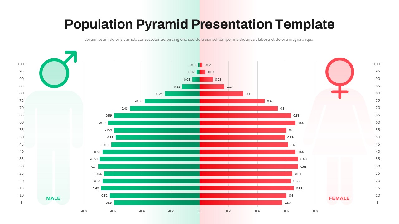
- A bar chart representation of the population distribution by gender across different regions, providing a statistical overview of demographic trends.
- A concise description of Dominica’s natural landscapes, tropical climate, cultural heritage (home to the Kalinago people), and economic reliance on tourism, agriculture, and fisheries.
This Dominica on map is fully customizable, allowing users to modify text, colors, and data to suit their presentation needs. Whether you’re a student, researcher, business analyst, or travel professional, this template provides an engaging and informative way to present Dominica’s key statistics, geography, and culture.
See more

Aspect Ratio
16:9Item ID
SKT03293
Features of this template
Other User Cases of the Template:
Geography and tourism presentations, Caribbean studies, international business analysis, demographic research, travel agency marketing, economic development reports, historical studies, educational lectures, government briefings, regional development planning.
FAQs
You May Also Like These Presentation Templates


- Free

- Free

- Free
- Free
- Free
- Free
- Free
- Free
- Free

- Free
- Free
- Free
- Free
- Free
- Free
- Free
- Free
- Free
- Free
- Free
- Free