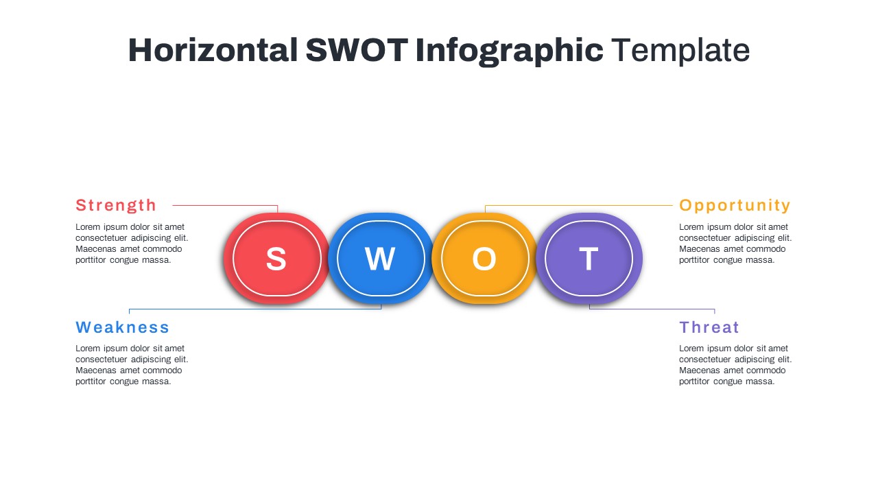
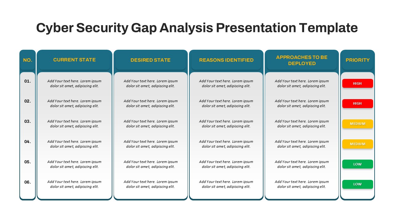
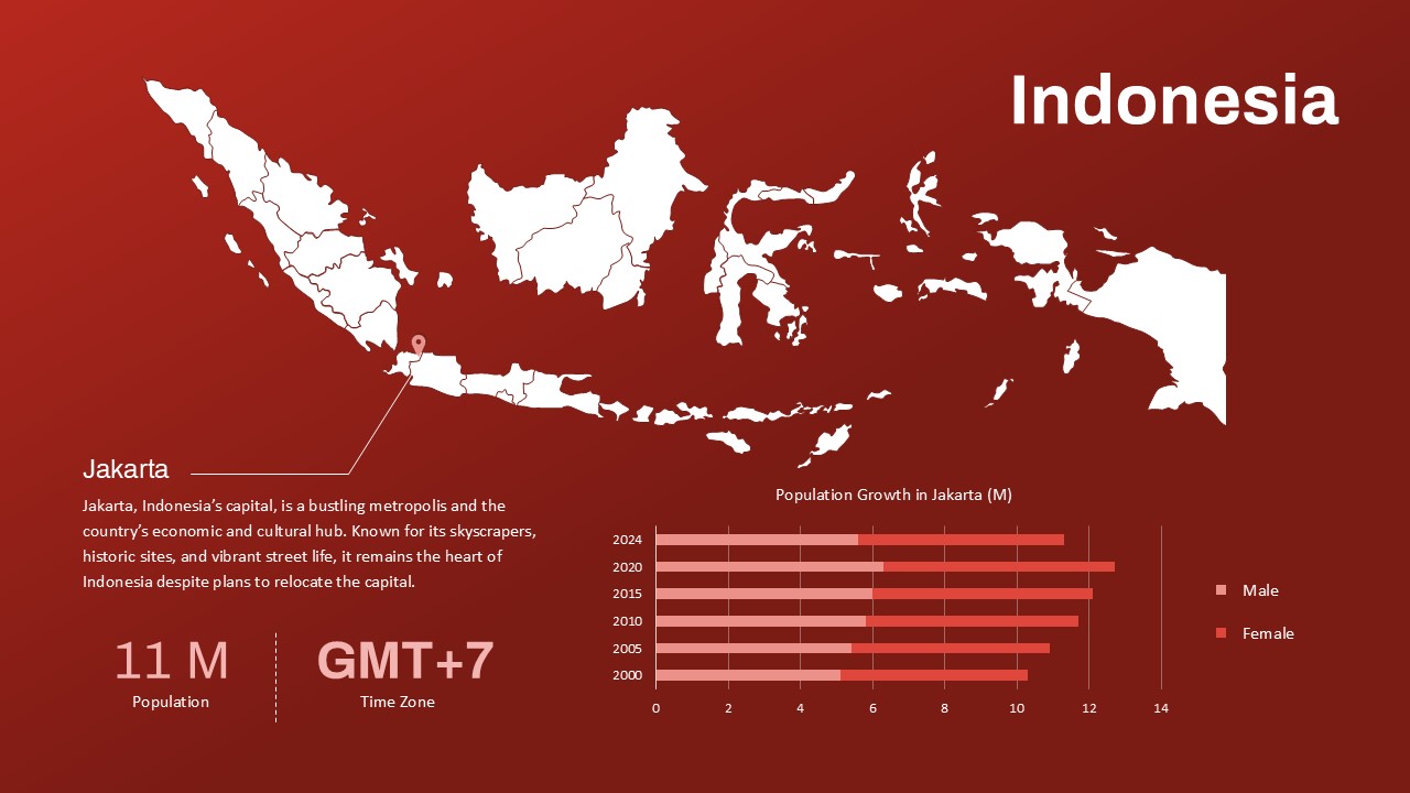
India Map For PowerPoint and Google Slides

The India Map For PowerPoint and Google Slides is a vibrant and fully editable visual designed to support presentations focused on regional insights, business expansion, geographic data, or market analysis within India. Featuring a detailed vector-based map of India with distinct state boundaries, this India map PPT slide is ideal for showcasing data distribution, location-based strategies, or demographic highlights across the country.
The left panel of the template includes a dedicated text space for presenting key insights, statistics, or contextual information, while the right side visually anchors the message with a high-quality, gradient-colored map. Key locations are highlighted with icon markers, offering a professional way to emphasize metropolitan hubs, regional offices, project sites, or sales territories.
With its bright orange gradient background and modern design, this template creates visual interest while maintaining clarity and focus. Perfect for corporate strategy meetings, academic presentations, government reporting, or NGO project tracking, it supports data storytelling with both form and function.
Designed for use in PowerPoint and Google Slides, the template is completely customizable—allowing users to change map colors, move markers, or update content to suit their exact needs. Whether you’re presenting state-wise performance, conducting a regional analysis, or planning an expansion roadmap, this India Map Template enhances your communication with compelling visuals.
See more

Aspect Ratio
16:9Item ID
SKT03446
Features of this template
Other User Cases of the Template:
Market expansion presentations, regional sales analysis, political or electoral insights, demographic studies, academic research on India, NGO project localization, logistics and distribution planning, business location strategy, tourism or travel pitch decks, state-wise performance trackingFAQs
You May Also Like These Presentation Templates


- Free

- Free


- Free